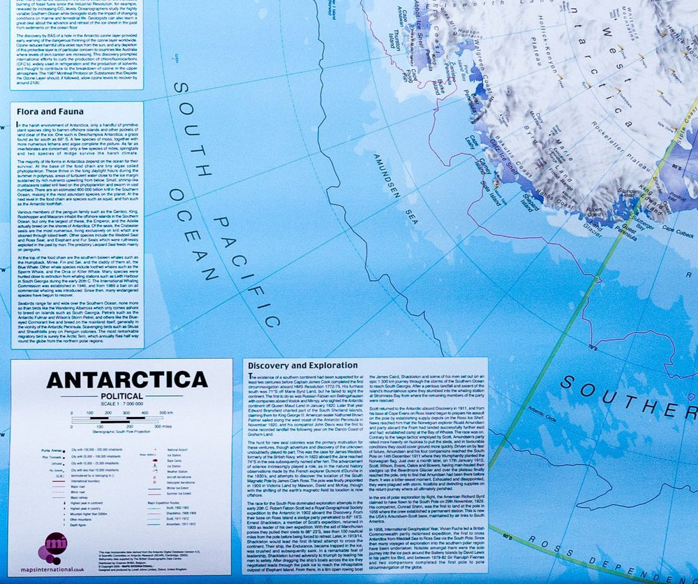


Antarctica and the Arctic 1:10 000 000 | British Antarctic Survey
Antarctica and the Arctic 1:10 000 000 | British Antarctic Survey
Regular price
$46.00
- Ships within 48 business hours from our US warehouse.
- Delivery costs calculated instantly in the basket
- Free returns (*)
- Real-time inventory
- In stock, ready to ship
Related geographic locations and collections: Antarctica, Arctic, The Poles