Carte routière - Israël & Palestine | Freytag & Berndt carte pliée Freytag & Berndt

Road Map - Israel & Palestine | Freytag & Berndt

Road Map - Israel & Palestine | Freytag & Berndt

Regular price $20.00
/
  • Shipping within 24 working hours from our warehouse in France
  • Delivery costs calculated instantly in the basket
  • Free returns (*)
  • Real-time inventory
  • In stock, ready to ship
  • Backordered, shipping soon
Tax included.

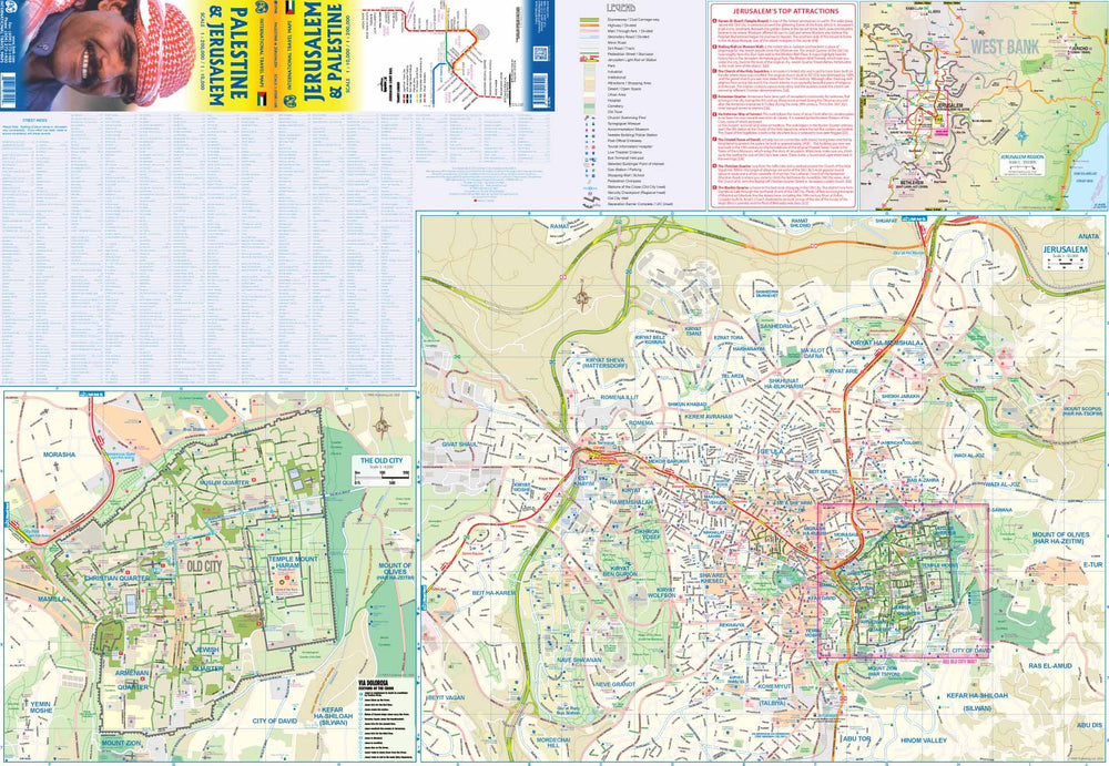
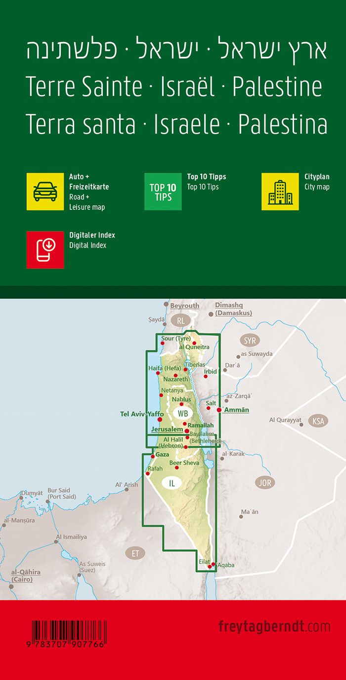
Map of Israel and Palestine published by freytag & amp Berndt. Symbols emphasize the 10 most visited sites, archaeological sites and religious sites, national parks and nature reserves, campsites in the region and youth hostels ...

Scale 1/150 000.


ISBN/EAN : 9783707907766
Publication date: 2023
Scale: 1/150,000 (1cm=1.5km)
Printed sides: both sides
Folded dimensions: 25.6 x 13 x 0.8cm
Unfolded dimensions: 95 x 137cm
Language(s): Czech, Dutch, English, French, German, Hebrew, Hungarian, Italian, Slovak, Spanish
Poids : 190 g

Customer Reviews

Based on 2 reviews
100%
(2)
0%
(0)
0%
(0)
0%
(0)
0%
(0)
J
JFS92 (Shefa-'Amr, IL)
Bien adapté

Actuellement les GPS et logiciels de géo-localisation sont très souvent bloqués par l'armée. Cette carte est donc indispensable pour circuler dans le pays.

A
Alain R. (Ergersheim, FR)

*****