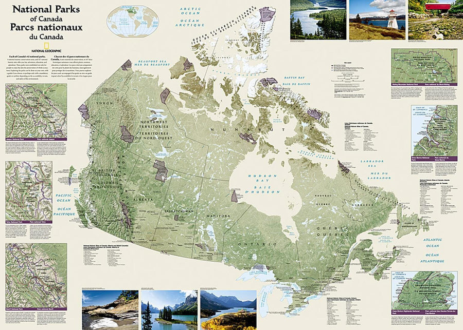
Canada National Parks Wall Map (42 X 30 Inches) (Tubed) | National Geographic
Canada National Parks Wall Map (42 X 30 Inches) (Tubed) | National Geographic
Regular price
$46.00
- Ships within 48 business hours from our US warehouse.
- Delivery costs calculated instantly in the basket
- Free returns (*)
- Real-time inventory
- In stock, ready to ship
Related geographic locations and collections: Canada, Canada Wall Maps, Wall Maps