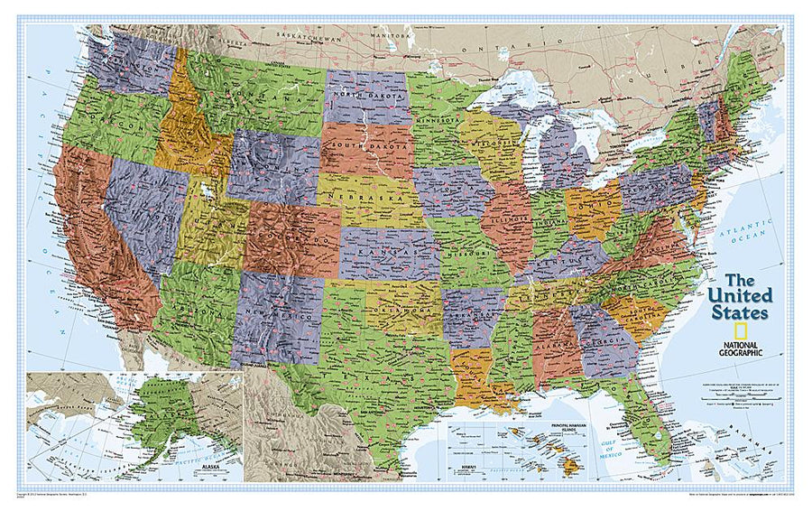


Wall Map - USA "Explorer" - 81 x 51 cm | National Geographic
Wall Map - USA "Explorer" - 81 x 51 cm | National Geographic
Regular price
$32.00
- Shipping within 24 working hours from our warehouse in France (except laminated models)
- Delivery costs calculated instantly in the basket
- Real-time inventory
- Low stock - 1 item left
Related geographic locations and collections: USA, USA Wall Maps, Wall Maps