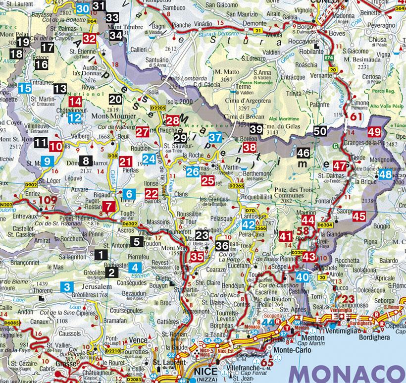
A brief description of the hike with all important information, a color map and a precise description of the itinerary for each excursion facilitate the choice and orientation on Square.
Summary and example - type photo. 168 pages, 87 color photos, 50 altitude profiles, 50 maps at 1: 25,000/1: 50,000/1: 75.000, a synoptic map at 1: 500.000.
Editor's note: If there is a paradise on Earth for hikers, the Maritime Alps in the south - east of France are certainly part of it. The landscape between the coast Azur and the peaks culminating at 3000 m is incredibly diversified and invites to hike 365 days a year. While beach amateur holidaymakers take a sunbathing, the others, hikers, bathe in the pleasant scents of rosemary, thyme, genet and lavender. The most beautiful jewel of this region is the Mercantour National Park, the newest of the six French national parks, which extends from the valley of wonders to the east to the department of Alpes - de - Haute - Provence by passing by Mount Gélas at 3143 m.
Even if hordes of tourists fall on the coast Azur in summer, loneliness begins in the Maritime Alps, just a few kilometers away as the crow flies of the Mediterranean Sea. This landscape is dominated by idyllic villages, mediterranean massifs of medium height and region, in alpine places, from Mercantour National Park. A few exceptions like fenetre Madone, St - Martin Vésubie, the Pass de la Bonette or Lake Allos, loneliness reigns, practically unimaginable thing for the trivial chest on the riviera.
Reinhard Scholl presents 50 hikes with half a day to one day, all described in detail and illustrated by a map and color photos. This Hiking guide will be a precious help during your wanderings in the hinterland Nice.