Carte topographique - Alt Empordà, Aiguemolls Emporda, Cap de Creus, Albera (Catalogne) | Alpina carte pliée Editorial Alpina

Topographic Map - Alt Empordà, Aiguemolls Emporda, Cap de Creus, Albera, Catalonia | Alpina

Topographic Map - Alt Empordà, Aiguemolls Emporda, Cap de Creus, Albera, Catalonia | Alpina

Regular price $27.00
/
  • Shipping within 24 working hours from our warehouse in France
  • Delivery costs calculated instantly in the basket
  • Free returns (*)
  • Real-time inventory
  • In stock, ready to ship
  • Backordered, shipping soon
Tax included.

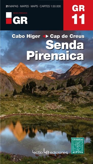
Topographic detailed map and hiking guide edited by Editorial Alpina covering the Alt Empordà (Catalonia, Spain). The detailed map is in color with the level curves.

1/50 000 scale (1 cm = 500 m). The Alt Empordà is a region of great contrasts in northern Catalonia: the coast is combined perfectly with the hostile and inaccessible mountain. The natural parks of the Empordà Aiguamolls and Cap de Creus are two protected areas that contribute to the conservation of a rich and fragile territory at the same time. In addition, the massifs of Albères and Salines, are the last two representatives of the Pyrenees chain before merging with the Mediterranean.
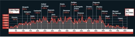
The map includes the entire Itierànnia road network, as well as a hiking trails that cross the region. : Gr 1 Gr 11, Gr 92, Gr 2 Gr 10
on the French side, and part of the path of St. Jacques. It also includes the location of all accommodation services, information points and areas of interest.


ISBN/EAN : 9788480907903
Publication date: 2019
Scale: 1/50,000 (1cm=500m)
Printed sides: front
Folded dimensions: 21 x 11.5 x 1cm
Unfolded dimensions: 99 x 68cm
Language(s): French, English, Castilian, Catalan
Poids : 152 g

Customer Reviews

Based on 1 review
100%
(1)
0%
(0)
0%
(0)
0%
(0)
0%
(0)
I
Isabelle (Lille, FR)
Cartes bien détaillées

Cartes bien détaillées qui correspondent à mon attente.. impeccable pour randonner et se repérer dans cette belle région de Catalogne.
Expédition ulra rapide.