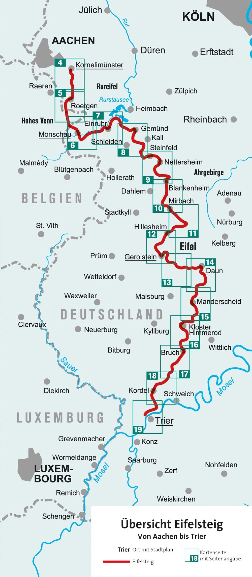
Topoguide Hiking - Eastern Townships & High Park Hautes Fagnes - Eifel - GR56 (Belgium) | The trails of great hiking (French)
Topoguide Hiking - Eastern Townships & High Park Hautes Fagnes - Eifel - GR56 (Belgium) | The trails of great hiking (French)
Regular price
$38.00
- Shipping within 24 working hours from our warehouse in France
- Delivery costs calculated instantly in the basket
- Free returns (*)
- Real-time inventory
- In stock, ready to ship
Related geographic locations and collections: Eifel, Liege (Belgium), Travel guides & practical guides, Wallonia