Wall map of Europe (Executive, Enlarged and Sleeved) published by National Geographic.
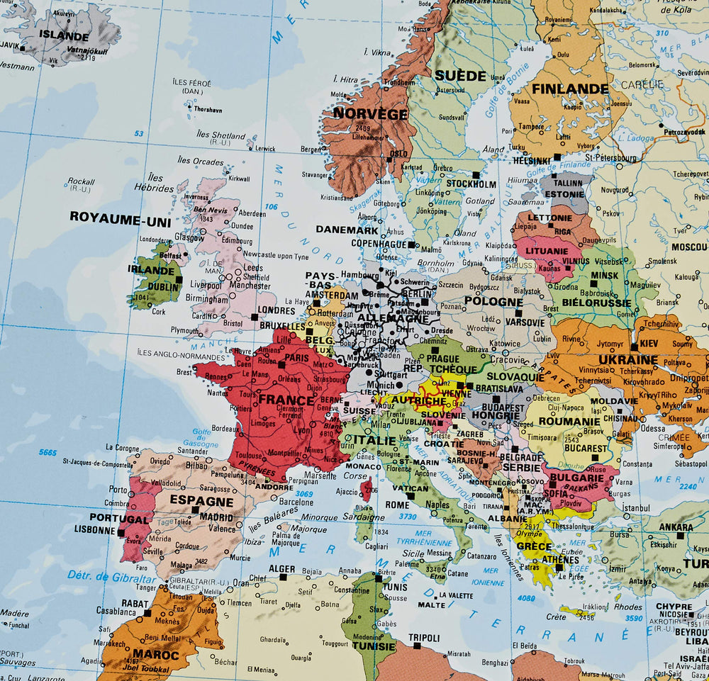
The Executive political map of Europe is a striking example of the cartographic excellence National Geographic is known for. The antique color palette, shaded relief, and easy-to-read fonts make this map both beautiful and functional. International boundaries are clearly defined and thousands of place names, waterbodies, airports, major highways and roads, national parks and more are included.
This map includes complete coverage of the countries and major cities of Albania, Armenia, Austria, Azerbaijan, Belarus, Belgium, Bosnia & Herzegovina, Bulgaria, Croatia, Cyprus, Czech Republic, Denmark, Estonia, Finland, France, Georgia, Germany, Greece, Hungary, Iceland, Ireland, Italy, Kosovo, Latvia, Liechtenstein, Lithuania, Luxembourg, Macedonia, Moldova, Montenegro, The Netherlands, Norway, Poland, Portugal, Romania, Russia, Serbia, Slovakia, Slovenia, Spain, Sweden, Switzerland, Turkey, Ukraine, and the United Kingdom.
Enlarged maps provide an immersive experience in any home or office environment. The exceptional cartography is even easier to appreciate at the larger size.
Scale 1:5,419,000.
Map size: 32.68 x 42.91 inches.