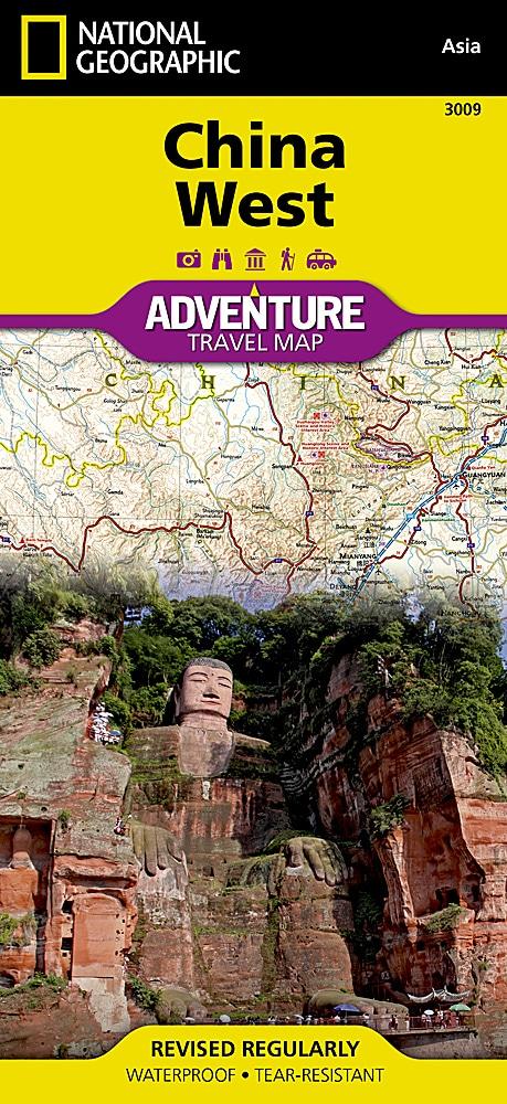
Western China Road Map published by National Geographic.
The most populous country in the world and one of the cradles of civilization, China is a leading destination for international travelers.
The Map of Western China of National Geographic provides details from the country, north and west of Changsha, Province of Hunan. These central and Western regions of China are among the least populated, but they are still very varied.
This map includes the three largest regions of China, Xinjiang, Tibet and Inner Mongolia Megalopolies Chongqing and Chengdu And many natural and artificial wonders like the Himalayan mountains, the Jiuzhaigou Valley, the terracotta army and the sections of the Great Wall.
The map includes a cities index and highlights areas of natural, cultural or historical interest such as national parks and reserves, Buddhist temples, mosques, caves, spas, hot springs, waterfalls, Botanical gardens and UNESCO World Heritage Sites. Highways, main and secondary roads as well as distances are indicated, as well as airports, ports, railways, trails and tracks.
This detailed map of China is waterproof and tearing resistant.
Scale 1/2 950 000 (1 cm = 29.5 km).
ISBN/EAN : 9781566955942
Publication date: 2011
Scale: 1/2,950,000 (1cm=29.5km)
Printed sides: both sides
Folded dimensions: 23.5 x 10.7 x 0.8cm
Unfolded dimensions: 96 x 65cm
Language(s): English
Poids :
89 g